Arizona
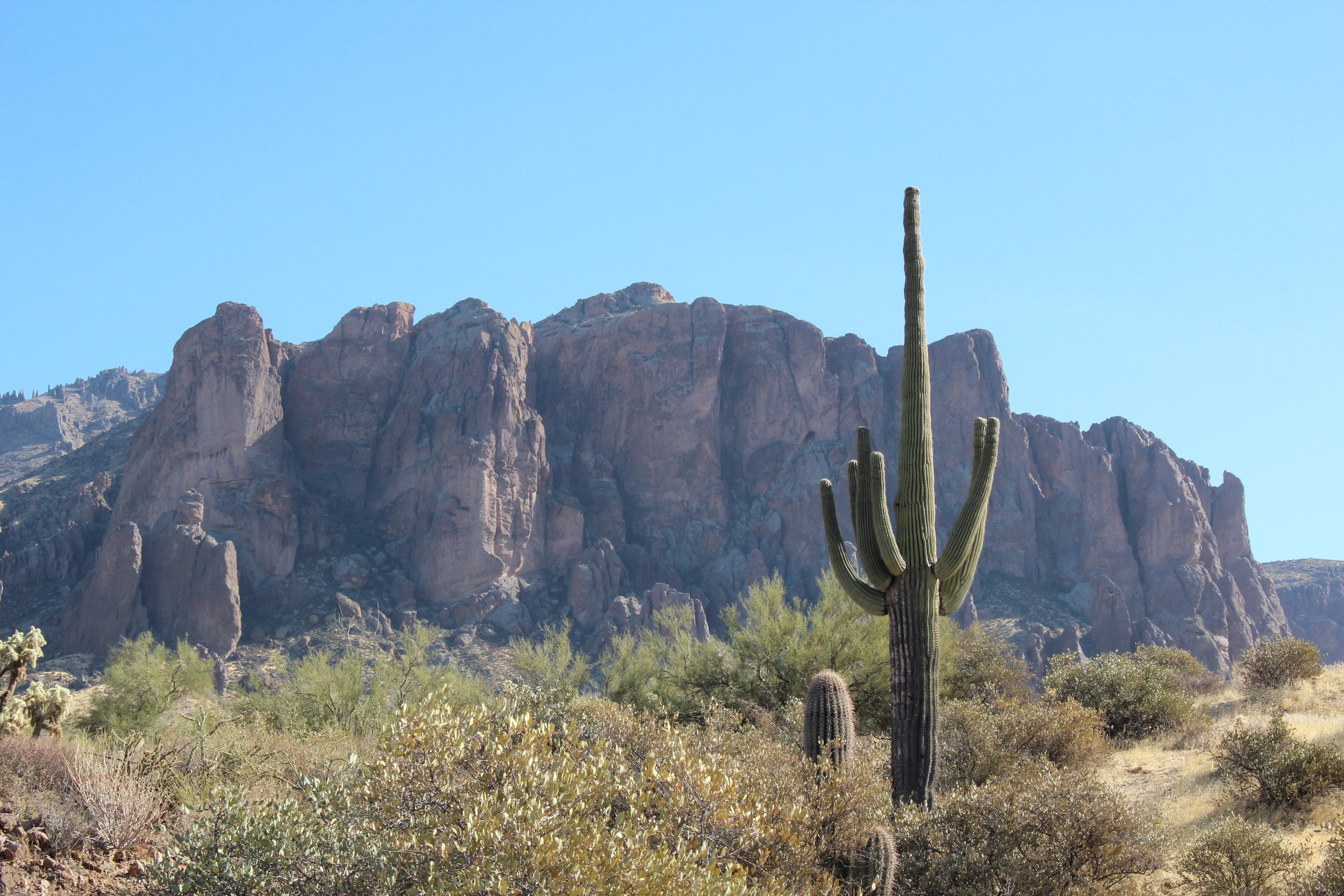
Arizona, the pinnacle of the American Southwest, is a region known for its desert landscapes, red rock formations, and vast canyons. The Sonoran Desert houses the largest saguaro cacti in North America, The Grand Canyon attracts millions of visitors each year.
Nature and history is balanced here with everyday life and culture. Scottsdale boasts a lively social and food scene, Sedona allows for self reflection among the rest rocks, and the Grand Canyon invites visitors to sink into it’s gorge. Arizona is a state where any outdoor enthusiast can feel at home.
Page
Page, AZ was origianlly developed to house workers of the Glen Canyon Dam. The land was purchased from the Navajo Nation in 1957. Natural landmarks, including Horseshoe Bend and Antelope Canyon, are located on Navajo land. Respectful tourism provides income for the Navajo people, conservation of the land, and education for visitors. Nearby, Lake Powell offers recreation and relaxation for visitors.
Points of Interest
Very popular & easy trail. Best to go off peak hours to avoid crowds
Bring sun protection and water, especially in summer
Parking fee $10 for passenger vehicles, cash only on weekends/holidays

Horseshoe BendAntelope Canyon
Only accessible by tour
Two options
Upper antelope canyon: more accessible and more popular
Lower antelope canyon: requires steep stairs to enter, more narrow (we chose this tour)
Be mindful, the Navajo Nation observes Daylight Savings, but Arizona does not
Note: expect crowds and to pay at least $40 per person to visit the slot canyon. There are slot canyons the can be accessed for free throughout the southwest, however if you like guided tours and seeing famous sites, this is a good option
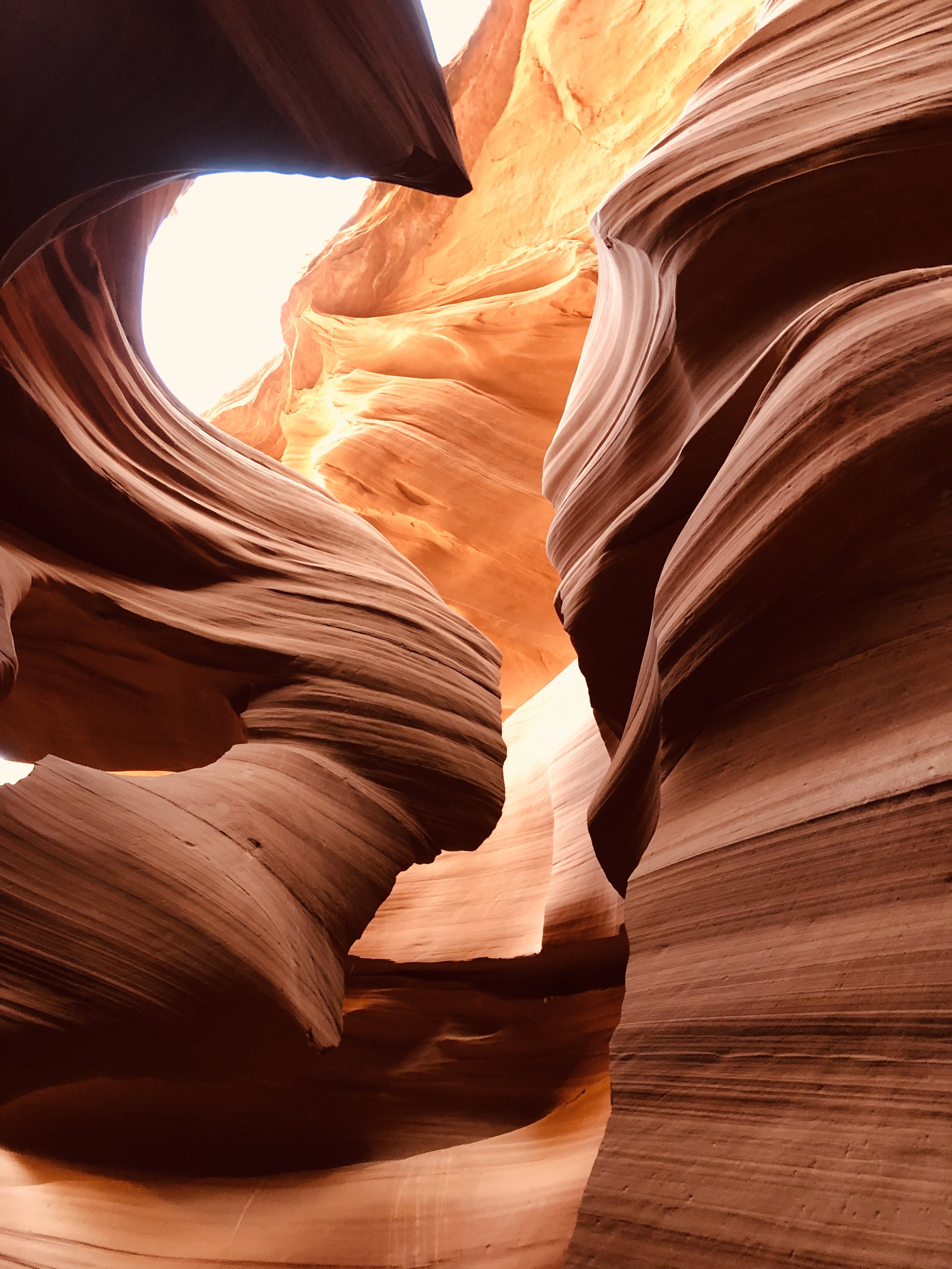
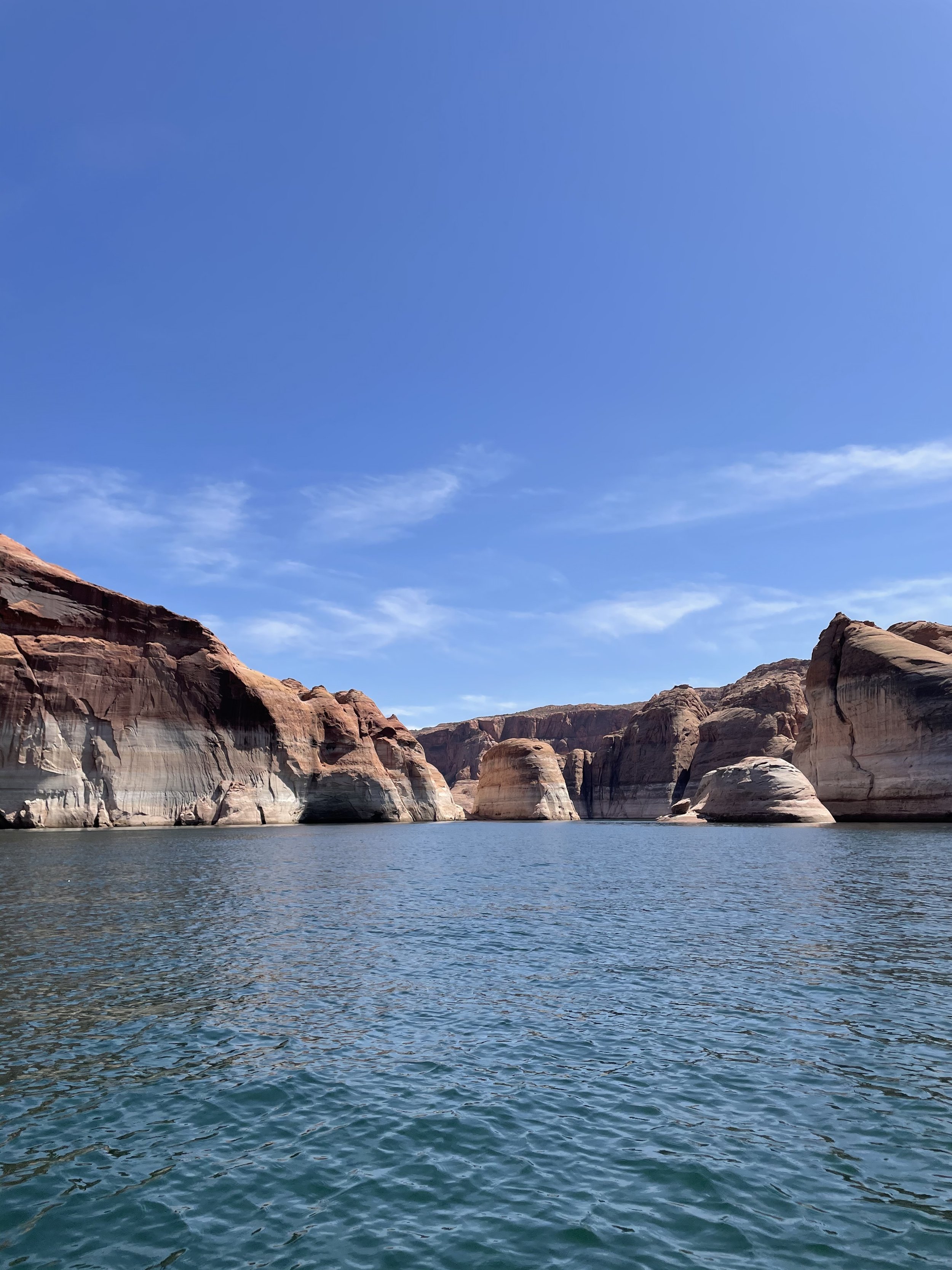
Lady in the Wind, Lower Antelop CanyonLake Powell
Outdoor recreation options: boating, jet skiing, kayaking, fishing, swimming, etc
Visit Antelope Point Marina for rentals and less crowds
Note: Lake Powells water comes from the Colorado River, which is used as a water source for CO, WY, UT, AZ, CA & NV. Due to use and climate change, the water levels vary. This is especially observant in the summertime
Read more about the Colorado River in “Where The Water Goes”
Lake PowellScottsdale & The Greater Phoenix Area
Scottsdale, located in the Phoenix metropolitan area, is known for its lively town strip, abundant food choices, and old town taverns. The town is backdropped by beautiful mountains and desert scenery, meaning some of the best hikes in the area are a short drive away. This guide focuses on Scottsdale town favorites and our the greatest hikes within an hours drive (many are closer!) The best times to visit are in the fall, winter and spring to enjoy outdoor recreation.
Eateries/Drinkeries
Sip Coffee and Beer - where your morning can blend into your evening, Grab a a nitro with CBD for a calming start of your day
Juice Core - delicious and nutricious smoothies, bowls, and coffee Ocean Potion smoothie (left) & Date Me Seasonal smoothie (right)
Coach House - Scottsdales oldest dive bar, open from 6am-2am, all drinks are $5, great place to start or end your nightGoldwater Brewery - adjacent to Sip Coffee and Beer, a quaint spot with outdoor seating in Old TownHappy Hour Specials

Diego Pops - best known for it's Mexican bites and margaritas, sister restaurant to The Montauk next door, happy hour 3-6pm everyday with $3 tacos every Monday! 
The Montauk - known for it's American bites and cocktails, happy hour 3-6pm everyday and all day on Monday! Hikes
Phoenix Mountains Preserve (~15 minutes from Scottsdale)
Distance: 2.6 mi
Elevation: 1,522 ft
Route Type: out & back
Difficulty: hard
Highlights: short and steep rock scramble, hiking experience recommended, beautiful views of town and landscape at top

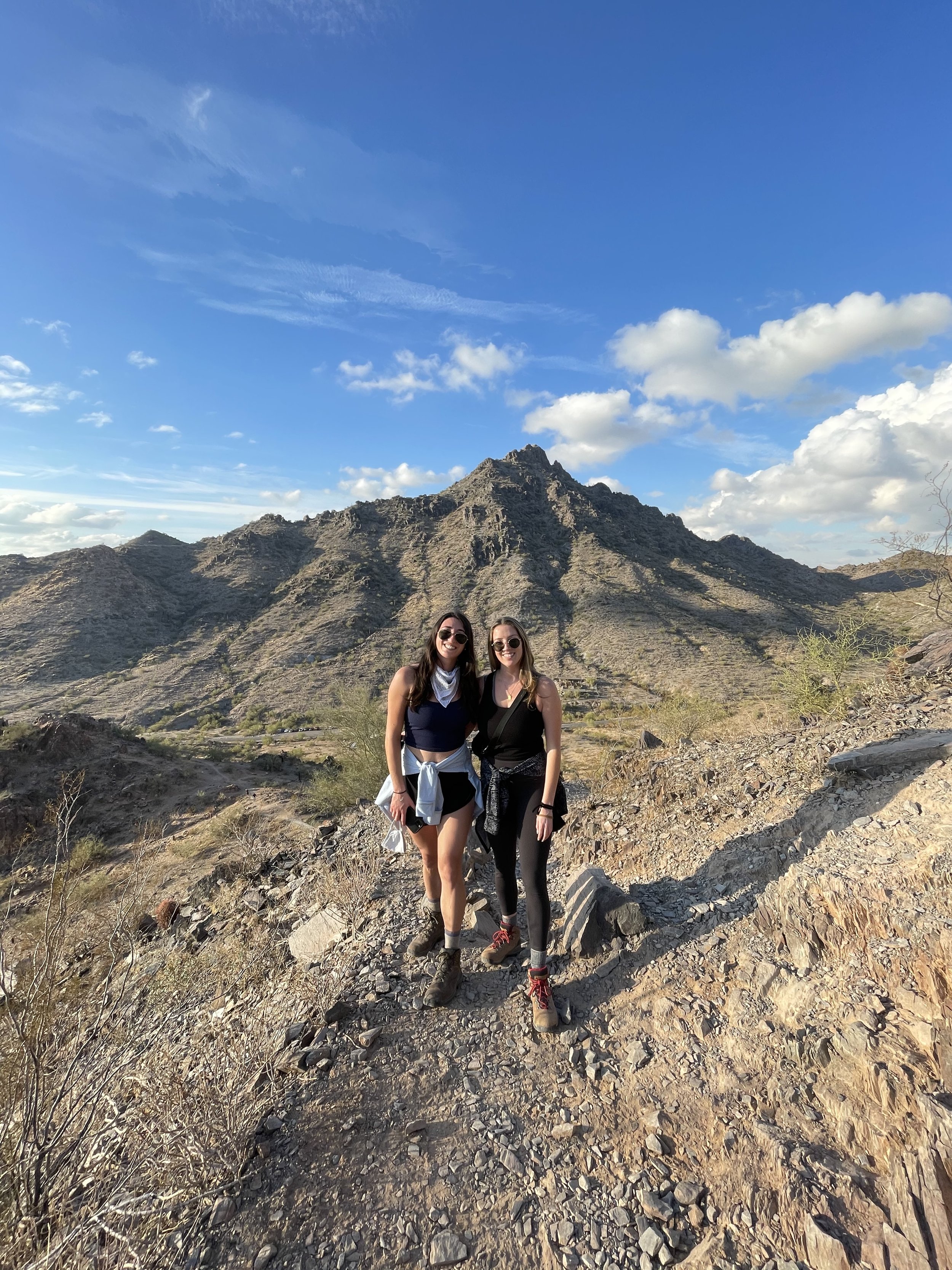
Camelback MountainDistance: 2.3 mi
Elevation: 1,151 ft
Route Type: out & back
Difficulty: hard
Highlights: steep “stair-master” trail with sweeping views of the landscape and town. Hike the route at sunrise to enjoy Taiko drumming at the peak
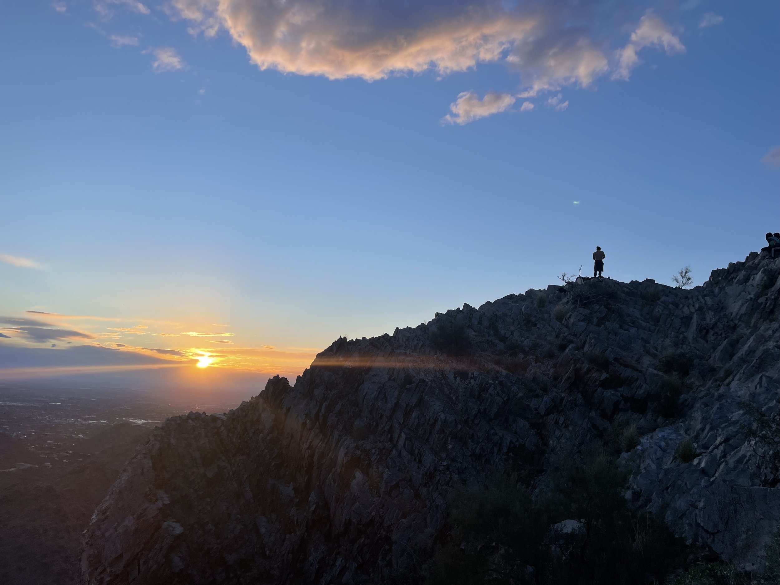
Taiko drumming by Ken Koshio at sunrise on Piestewa Peak Trail
200A Loop, accessed from parking area in Phoenix Mountain Park instead
Distance: 2.1 mi
Elevation: 610 ft
Route Type: loop
Difficulty: moderate
Highlights: across from Piestewa Peak, you’ll find mohave 200A (one of my favorites since it’s easy with great views). Park at Phoenix Mountain Park instead of the small lot off of Lincoln Drive. This trail is dog friendly and offers great city and landscape views, without the elevation of Piestewa Peak
Mohave Trail 200, with friends Carly (left) and Gabby (right), Piesetewa Peak pictured in background
McDowell Sonoran Preserve (~1 hour from Scottsdale
Distance: 4 mi
Elevation: 1,216 ft
Route Type: out & back
Difficulty: moderate
Highlights: switchbacks lead to Tom’s Thumb spur. Features dessert views. Pack sun protection and water
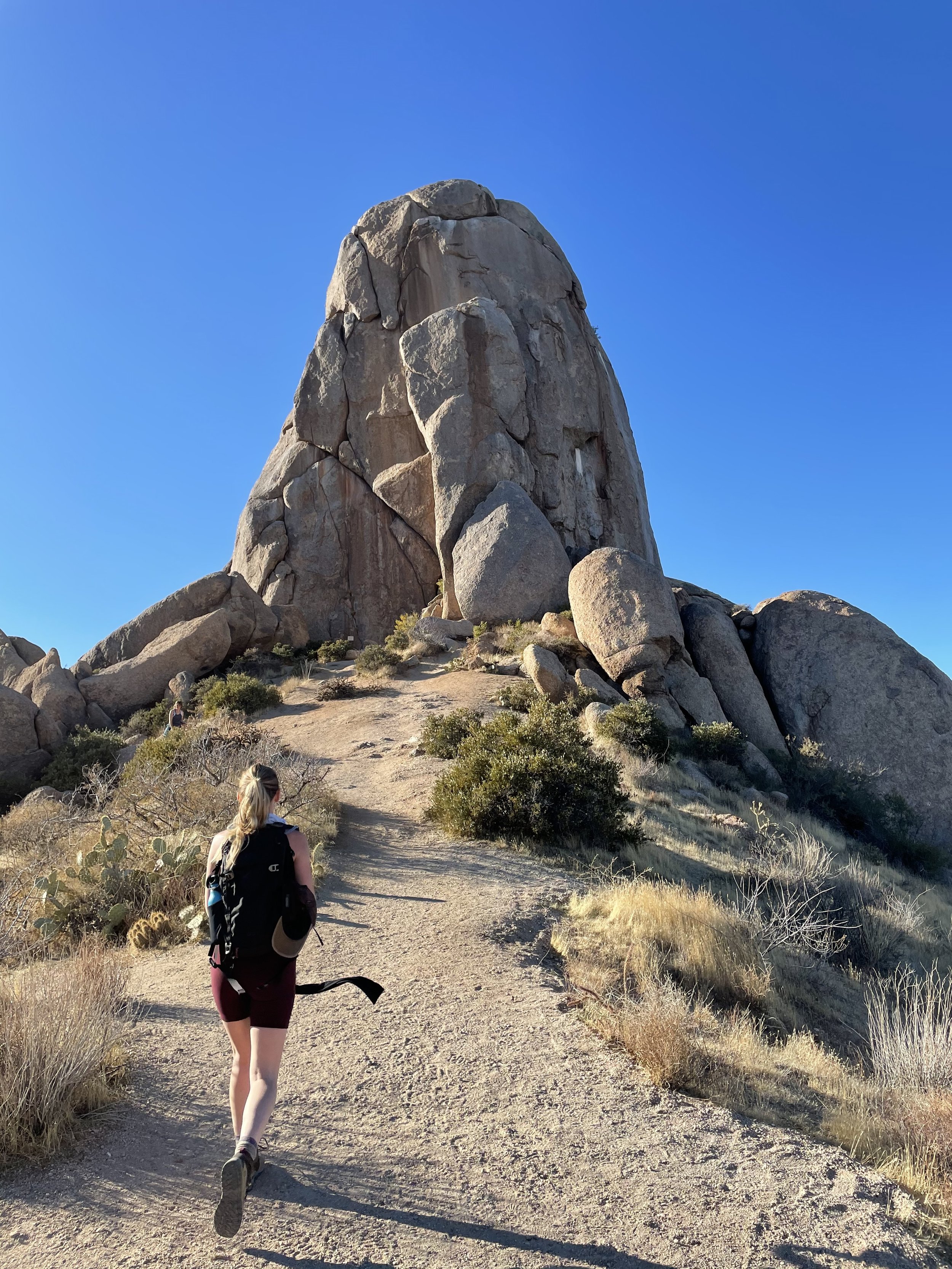
Tom’s Thumb
Tonto National Forest (~1 hour from Scottsdale)
Distance: 5.5 mi
Elevation: 2,627 ft
Route Type: out & back
Difficulty: strenuous
Highlights: challenging scramble recommended for seasoned hikers only. Start early or late in the day to avoid full sun. Pack water and wear hiking boots. Snow is possible in winter on peak, dog friendly but I would not bring our dog due to the strenuous scramble
Flatiron Trail, view from start of trail 2,600ft below mountain peak
Distance: 4.7 mi
Elevation: 1,289 ft
Route Type: out & back (or optional loop return on Praying Hands Trail)
Difficulty: strenuous
Highlights: leisurely walk to a moderate scramble, good scramble for beginners. Partial shade in early morning opens to full sun as day goes on. Check waterfall conditions before going (it was dry when we went but the views were still great), dog friendly

View on the way down from the Canyon of the Waterfalls
Monument Canyon and Broadway Cave via Jacob's Trail
Distance: 3.7 mi
Elevation: 803 ft
Route Type: out & back
Difficulty: moderate to hard
Highlights: easy walk on Jacob’s trail to a moderate to hard scramble that leads to Broadway Cave. Dog friendly (be careful of cacti), enjoyable trail with a unique view

Broadway Cave, photo taken from Jacob’s Trail
Personal Note
We began our van life journey in Arizona. In April of 2021, Austin caravanned out to the desert to meet my friends and I in Scottsdale. My friends and I had spent three months traveling around the American Southwest and had met Austin while in California.
Austin had newly acquired a converted Ford Econoline. On a whim, he made the journey from San Diego to Scottsdale, caravanning alongside his friend Dylan in his Astrovan. We spent a week getting to know each other. We decided to try living and traveling together in the van. Both originally from the east coast, we made a pact to drive back to New York together. Coincidentally, we never stopped driving and have now made four laps around North America. We now travel in our self converted Ford Transit van.
Scottsdale holds a special place in my heart for two reasons. It’s the place we began our van journey and it’s the place my nomadic ventures began with my three best friends. With them, I had the confidence to take a chance on a partner and a lifestyle that opened up my world.

Austin and I’s first photo in our Ford Econoline, Scottsdale AZ
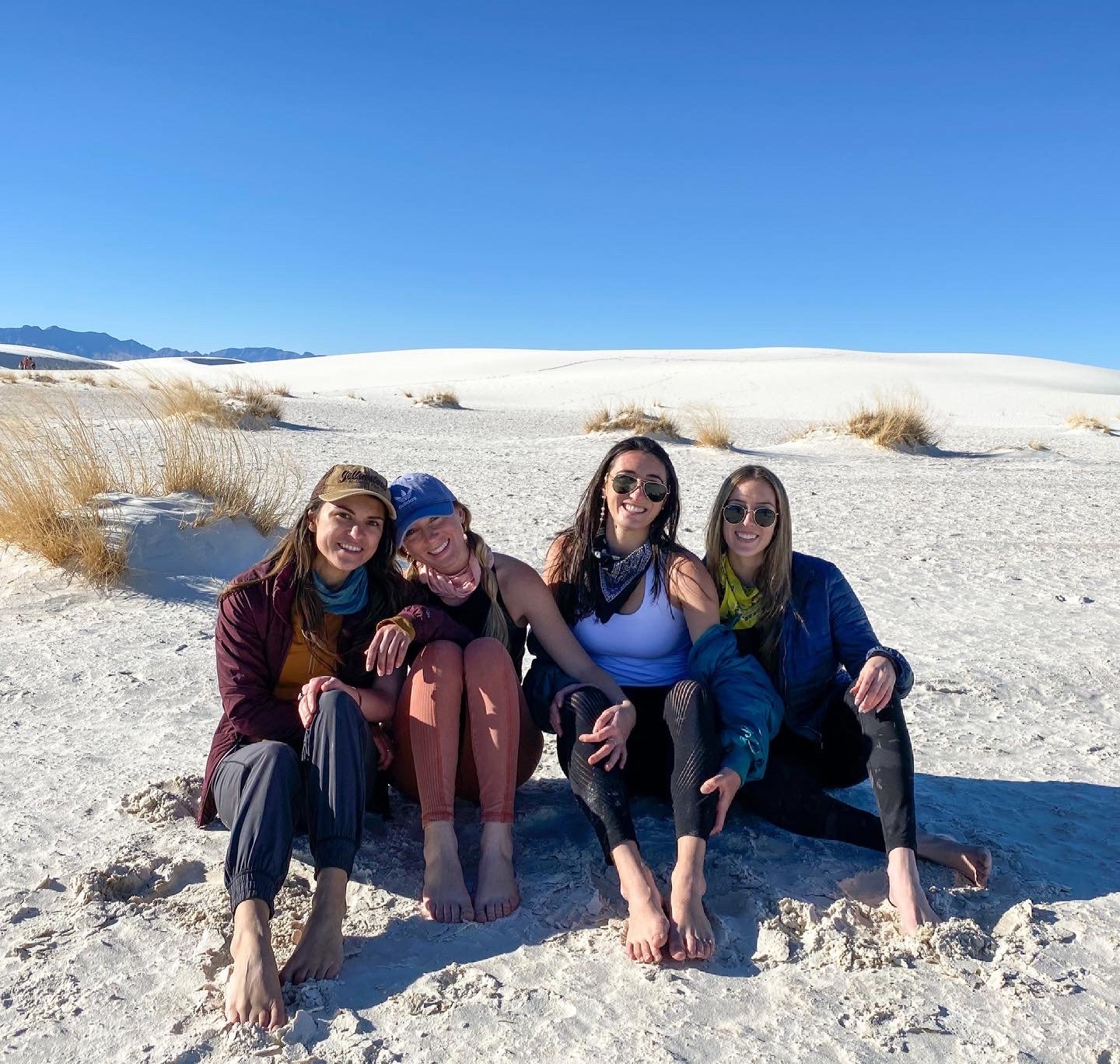
Jess, Dani, Carly & Gabby (left to right), White Sands National Park
Sedona
Backdropped by red-rock buttes and pine forests, Sedona is known for immersing oneself into nature and harboring spiritual vortexes. It’s a ideal place to visit to enjoy the desert landscape, hike sandstone buttes, and facilitate medication or healing.
Eateries/Drinkeries

Sedona Beer Company - perfect spot for a post hike meal, opt to sit outside to enjoy views of the butteHikes
Distance: 1.2 mi
Elevation: 741 ft
Route Type: out & back
Difficulty: hard
Highlights: short and steep scramble to an energy vortex, pack sun protection and water, and wear your hiking shoes

Ledge at Cathedral RockTucson
Tucson is an eclectic and artsy desert town surrounded by the convinces of modern day America. Walk down fourth avenue visit shops or restaurants. Outside of town, you can visit Saguaro National Park or sleep on BLM land. Check out our Saguaro National Park section for more info on nearby hikes in the park.
Eateries/Drinkeries

Thunder Bacon Burger Co, a popular spot, perfect to pick up a burger and fries to enjoy at Crooked Tooth Brewing Co. A cozy brewery that offers beer flights, take out food, and spcace to play cardsHikes
Phoneline Trail to Blackett's Ridge and Saddleback
Distance: 5.7 mi
Elevation: 1,778 ft
Route Type: out & back
Difficulty: hard
Highlights: the right amount of challenging with a rewarding view at the end. Located in Sabrino Canyon Recreation Area

Peak of Blackett's Ridge, pictured friend DaniChiricahua National Monument
Chiricahua sits in the southeastern corner of Arizona and is known as a wonderland of rocks. If I had to guess, it will soon become a National Park as it’s landscape is worth seeing. The park is free to access for all visitors. Stop by the visitor’s center to learn more about the parks history and the animals that inhabit the land.
Hikes
Distance: 3.2 mi
Elevation: 557 ft
Route Type: loop
Difficulty: moderate
Highlights: walk counterclockwise around this loop to take in the rock formations. Hike for sunset to see a particular glow on the rocks, then stay for nightfall to stargaze in a dark night sky
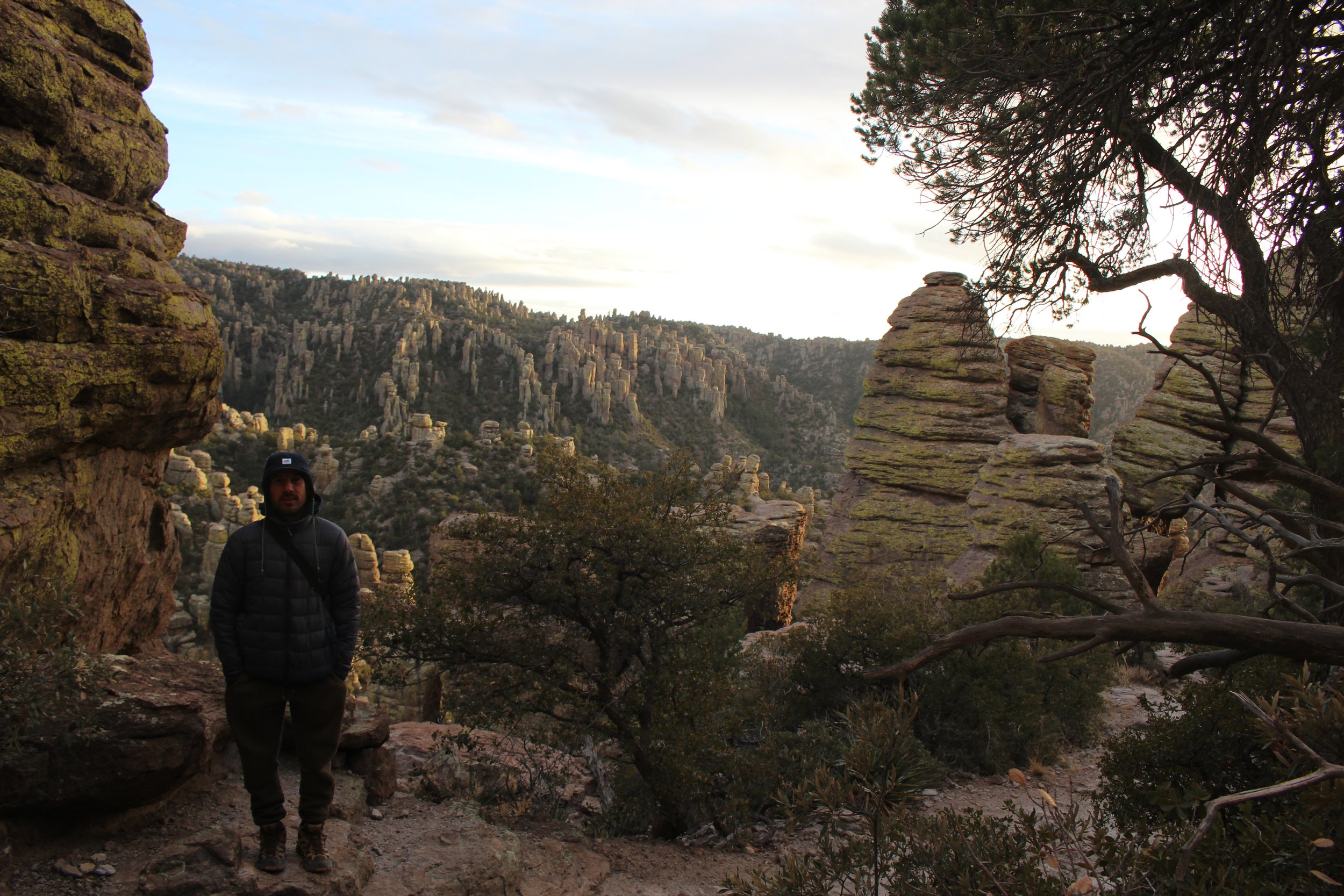
Austin standing in front of rock formations on Echo Canyon LoopCampsites
Outside Chiricahua National Monument
Location: on the forest service road outside the monument
Highlights: free camping along the forest service road, use your discretion on how far you’d like to go as it’s a primitive road. We slept by the welcome sign
Outside Chiricahua National MonumentGrand Canyon National Park
The Grand Canyon was formed by the winding waters of the Colorado River over the past few million year. We visited the Southern Rim, where the visiter’s center and village are located, making it the more populated area of the park. The canyon truly lives up to it’s name. Take time here to bask in the grandness of the most visited national park in the US.
Hikes
South Kaibab Trail to Cedar Ridge
Distance: 3.1 mi
Elevation: 1,181 ft
Route Type: out & back
Difficulty: moderate
Highlights: hike down switchbacks to see sweeping views of the canyon
Note: be prepared to hike back up & out of canyon with water and sun protection

Mules walking up the South Kaibab TrailDistance: 15.8 mi
Elevation: 4,501 ft
Route Type: out & back
Difficulty: hard
Highlights: beautiful canyon views, Havasupai Gardens located 4.8 miles in, a backcountry permit is required for overnights
Note: be prepared to hike back up & out of canyon with water and sun protection, you do not need to hike the full 15.8 miles to enjoy this hike

Bright Angel TrailCampsites
Location: South Rim, nearby the Canyon Village
Highlights: nearby trails, walking distance to shops/good, lots of elk!

An elk at Mather CampgroundPetrified Forest National Forest
Petrified Forest National Park is known for its Triassic fossils, dainted desert, and petrified wood. Located directly off I-40, it’s worth the stop if passing by.
Hikes
Distance: 4 mi
Elevation: 423 ft
Route Type: out & back
Difficulty: moderate
Highlights: light elevation at start of trail leads leisurely walk through the painted desert into the petrified forest
Note: we did not venture farther into the park due to time constraints

Rim View of Painted DesertSaguaro National Park
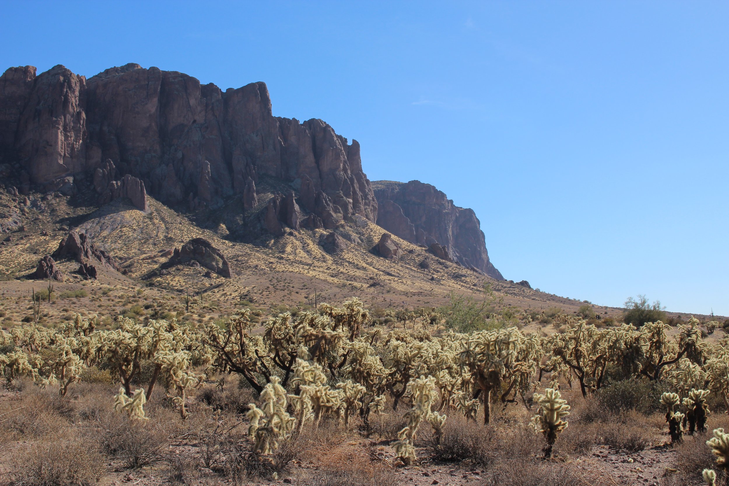
Saguaro National Park has two sections on the west and east side of Tucson. We spent our time here on the east side. Saguaro is an icon for the American west as it houses our largest cacti. Immerse yourself around the local flora and fauna by taking a stroll through the desert or climbing a mountain.
Hikes
Tanque Verde Dome
Distance: 5.2 mi
Elevation: 1,522 ft
Route Type: out & back
Difficulty: moderate
Highlights: steady incline leads to beautiful views of the dome, many cacti and desert views long the way

Austin waving with cactus on Tanque Verde Dome TrailDistance: 5.9 mi
Elevation: 1,076 ft
Route Type: out & back (or option to make it a loop)
Difficulty: moderate
Highlights: breathtaking desert views, abundant cacti, and if you’re lucky a waterfall at the end (depends on rainfall so check conditions beforehand)
Desert landscape along Douglas Spring Trail to Bridal Wreath Falls